Navigation is one of the key elements for a successful and safe outdoor adventure. Bringing a map and compass is essential, but there is the additional option of using a GPS as well. Buying a GPS unit is quite an investment, but fortunately we’re pretty sure you already own one. Did you know you can use your smartphone as a GPS for your outdoor adventures? Here is how.
Smartphones as a navigation tool
Nowadays everyone has a smartphone. Since these have an in-built GPS signal that is constantly tracking from satellites circling the planet, they have become a go-to navigation tool for many hardcore backcountry travelers. The signal is a strong one as well, even if you spend days or even months out of range of cellular signals. I used my smartphone for navigating during my kayak expedition in Spitsbergen and it worked smoothless, despite not having a phone signal. Smartphones are more space- and weight-efficient than dedicated GPS units, particularly since phones can take photos too.
GPX files
If your adventure is hiking an existing trail, than it’s easy to use your smartphone for navigation. Hiking trails can be downloaded to your smartphone. They come in a gpx file. This type of file contains GPS data saved in the GPS Exchange format, an open standard that can be freely used by GPS programs. It contains longitude and latitude location data, which includes waypoints, routes, and tracks.
To read the data, all you need is to download an app that can open it. I use GPX viewer as this is a free application that can be downloaded from the Google Play Store and and the App Store.
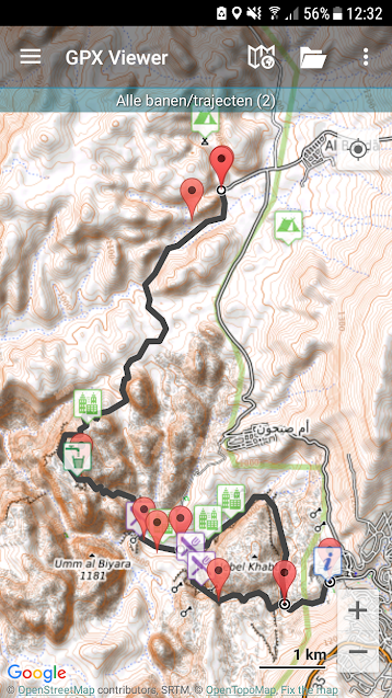
When opening the file, it should look like this.

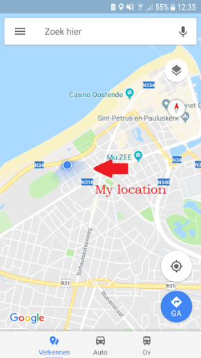
To see if you are still on the trail, the GPS signal from your phone will show your exact location on the screen with a blue dot. If the blue dot is located on the trail line, you are still on the right track.

The blue dot marks your exact location
Where to find gpx files?
To navigate your trail with your smartphone, you will need a gpx file as a source. These can be from plenty of places, find them with Google. Here are just a few that work for me.
Create your own trail
Besides hiking an existing trail, there is the fun option to plot your own backcountry route and create a gpx file of it.
Alltrails Pro version allows you to plan and draw your own map on your laptop and download them as gpx files.
Caltopo (Free) is another option for creating your own custom routes and download them as gpx files to your smartphone. You can print your maps to pdf as well.
GPX generator is a free website to create your own gpx files, but has fewer options. Though it might be enough to create simple routes.
Some remarks when using smartphone as GPS
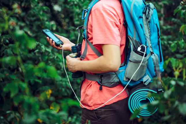
- Using your smartphone as a GPS will have its effects on the battery life of your phone. Make sure you are able to recharge it at any time to prevent from not being able to call for help in emergency situations. We recommend using a powerbank and / or solar panel.
- Using GPS may use data roaming. When abroad, it is advisable to purchase a local data sim card to avoid high roaming costs.
- Using your smartphone in wet conditions may result in damaging it. To avoid getting your smartphone wet (rain, snow, …), use a waterproof bag to store it in.


Hi, yes this article is really good and I have learned lot of things from it concerning blogging. thanks.카지노사이트
LikeGeliked door 1 persoon